

Vertical Alignment
Discover Tessera's vertical alignment features for seamless road design, including profile creation, drainage inspection, and Bruckner diagram calculation.
Overview
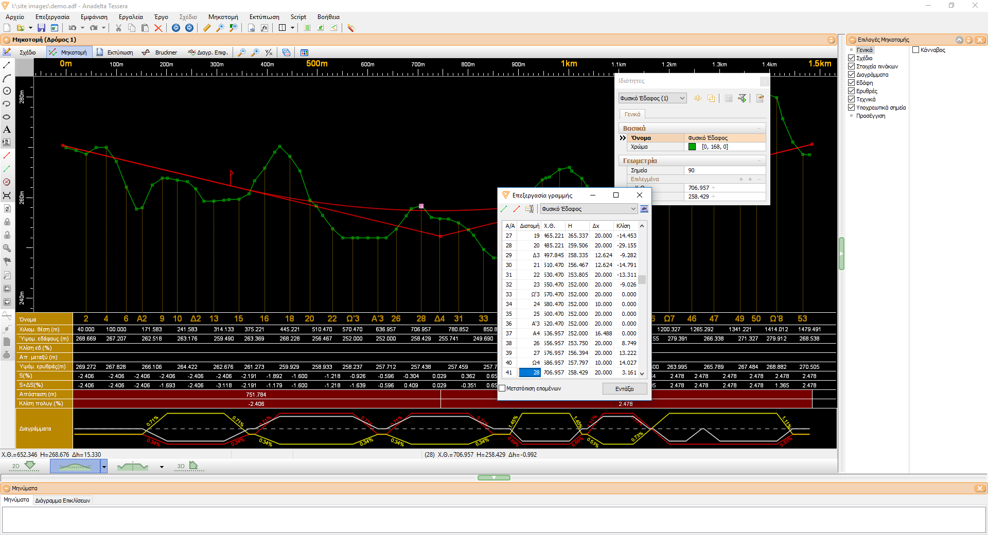
Right after placing the cross sections in Horizontal Alignment, we can query the TIN for the underlying natural ground data. The road profile can be either inserted visually by using the mouse, or imported from either a table or a text file. Along with the curvature radii, it can also be visually modified, while Tessera uses the display colors to alert the user on any problematic areas. In addition, it displays a wide variety of information on the editing window, such as the vertical distance from the natural ground, the slope of the road tangent curve and the natural ground, the curvature diagram, the superelevation rate diagram, etc. A notable feature of the program is the capability to automatically reform the road profile after any Horizontal Alignment modifications, thus minimizing the amount of manual changes required.
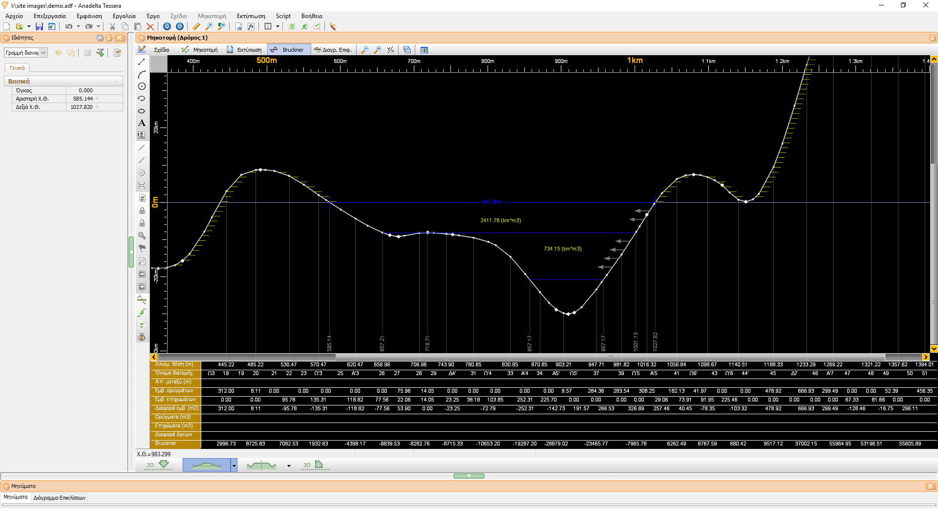
Bruckner Diagram
Once the quantity table has been calculated, Tessera can produce the surface diagram as well as the Bruckner diagram. By means of a specialized editing environment the user can insert distribution lines, optimize their position as well as calculate and print the earth mass moving table in order to calculate the excavation and transfer cost.