

3D
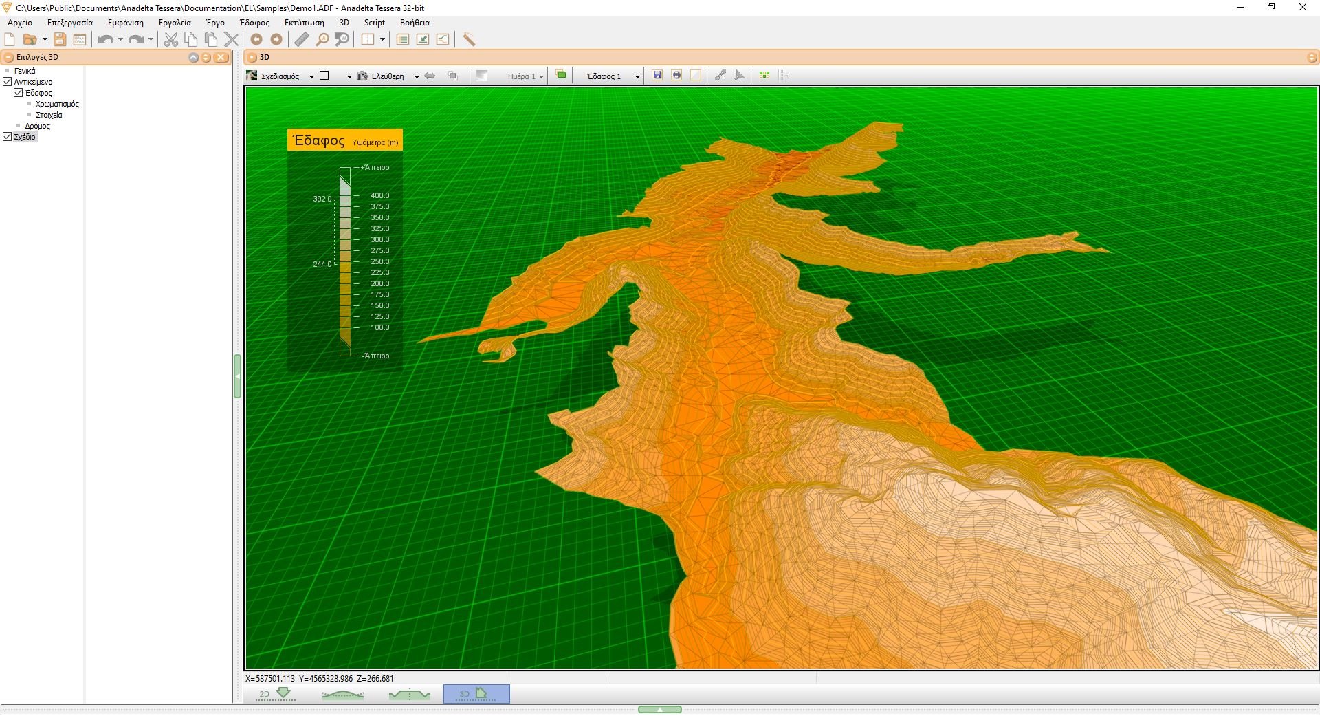
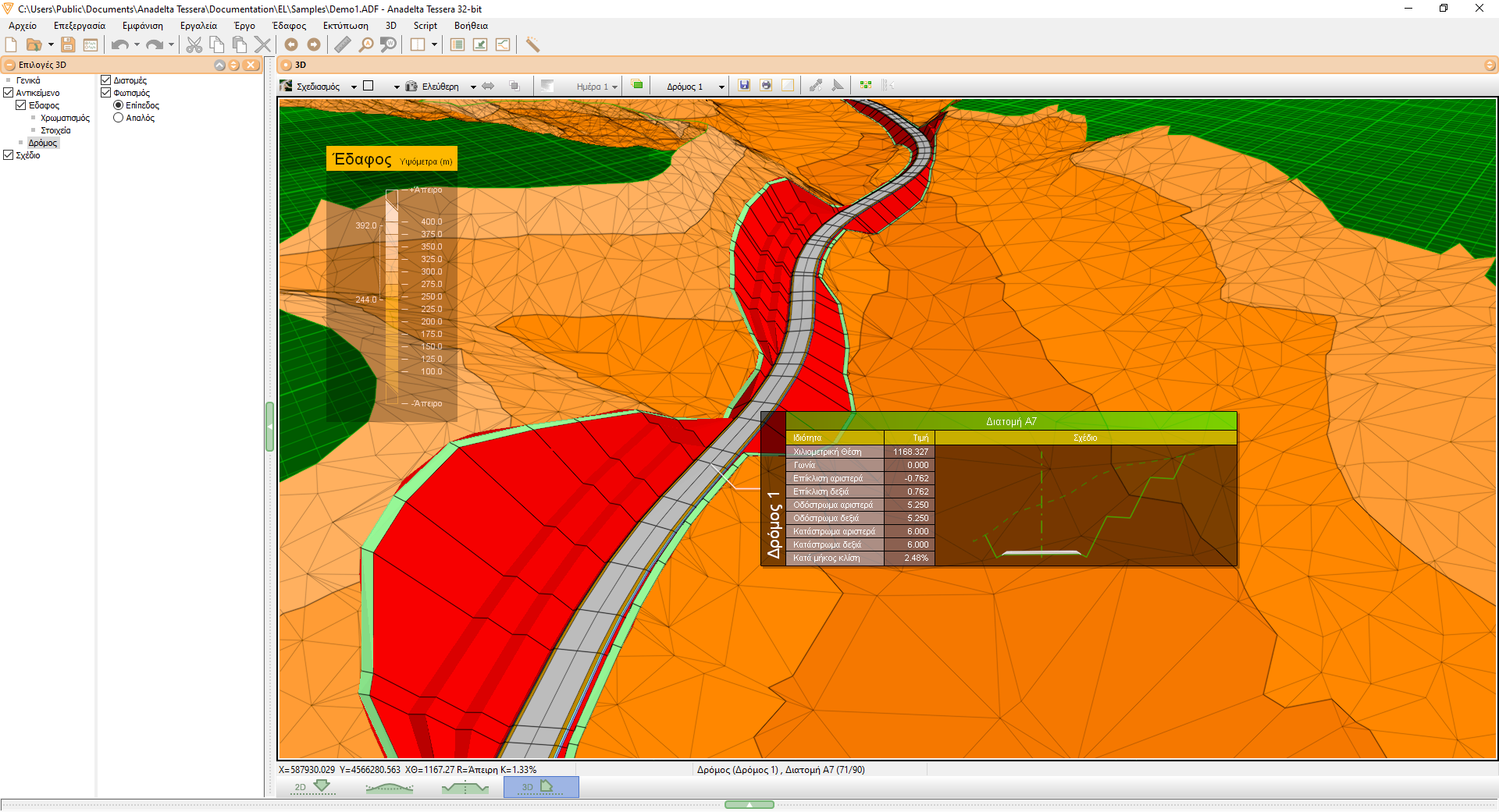
Three-dimensional survey
Beyond merely displaying a rendering of the finished project, the 3D environment is an invaluable tool for both inspecting as well as modifying the project throughout its production. It can aid the user during the initial road planning stage, it can greatly facilitate local terrain modifications by providing 3D editing capabilities and it can function as an efficient surveying tool.
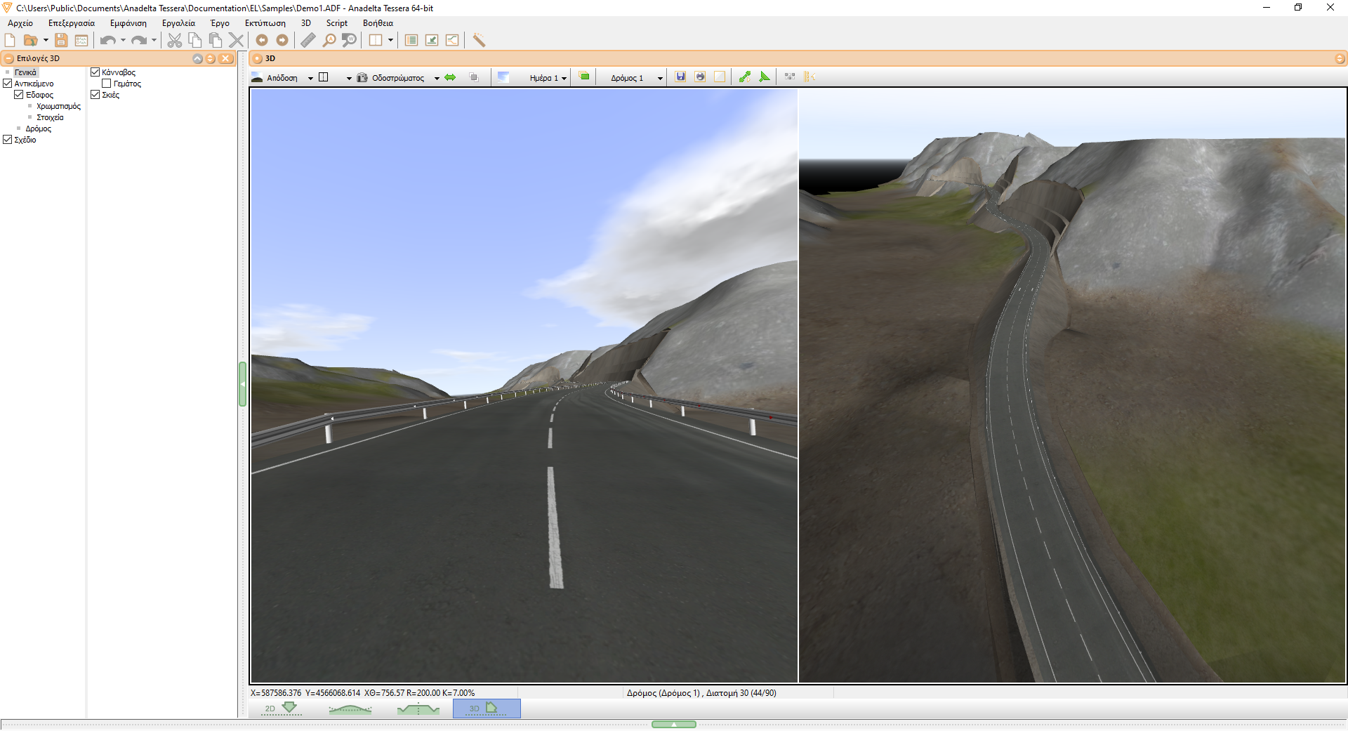
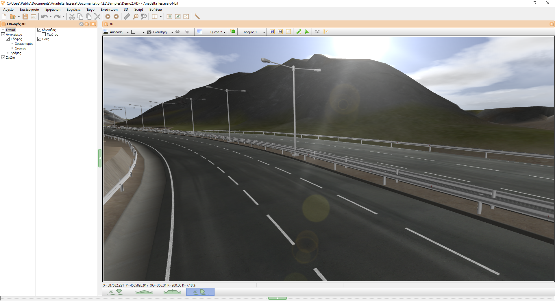
Rendering
When in Rendering mode, Tessera can depict the road's additional infrastructure as it has been designed by the user (eg. roadside barriers, New Jerseys, walls, streetlights, etc). It also features the ability to define and render the road's horizontal markings (eg. lane stripes, intersection markings, directional arrows, surface text, etc). In addition, in order to further enhance the photorealistic qualities of the presentation, the rendering engine can simulate a number of environmental factors such as the time of day and the desired weather conditions.
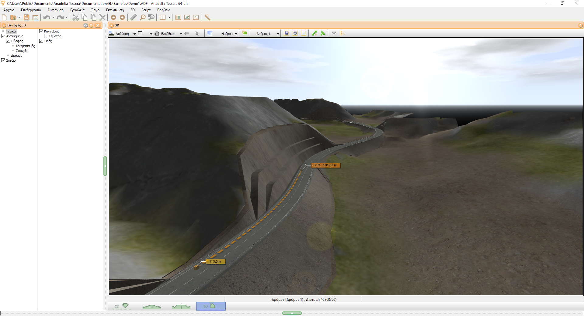
Visibility
The 3D environment provides the user with an easy and effective way to examine and verify the program's visibility calculations. To this end, it can be used both as a visual inspection tool as well as to indepedently recalculate visibility using the three-dimensional model of the constructed road and nearby terrain.
Video
Tessera can create video files suitable for presentations. The user can exert extensive control over the final output by specifying a range of options, such as defining the camera path and animation parameters. Alternatively, a number of predefined settings can be used, making the production of a presentation video very easy. Once a file has been created, it can be transferred and played by any media player without requiring the presence of the program or any additional files.
Printing / Bitmap Exporting
The contents of the screen can be printed or exported to a bitmap at any time. Tessera can render the displayed image at arbitrary resolutions, suitable for producing high quality plotter printouts. In addition, the exporting process can be automated via batch operations. For example, Tessera can produce an image of the road at each vertex or at each cross section, using predefined camera and rendering settings.