

Roadway Design
Tessera is an advanced road design software developed to streamline and enhance the process of design, pre and post-construction analysis of roadways. It offers a comprehensive suite of tools that allow engineers to efficiently plan, design, and analyze roadways with precision and accuracy. Tessera integrates powerful algorithms and user-friendly interfaces, making it easy to navigate complex projects, from initial conceptual design to detailed final plans.
Main roadway features
The user can create and process an unlimited number of roads. For every road and in every stage of a project, any of the default parameters such as the design speed, initial widths, superelevation rate calculation mode, regulation types, etc. can be changed.
Roadway definition and editing
The road can be defined in many ways: visually by using the mouse, by importing data from a text file or by typing the coordinates by hand on a table.
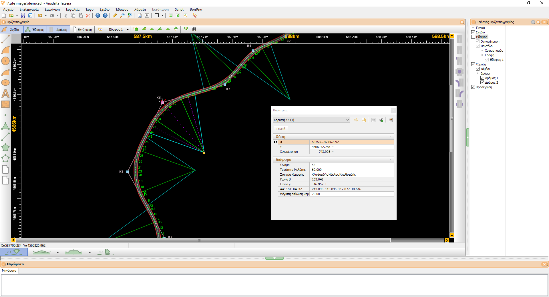
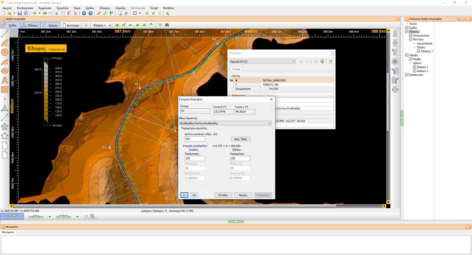
When inserting the axis visually, the program's capability to snap to any design objects (lines, curves or characteristic points) can greatly assist the user. Tessera suggests initial values for the transition curve properties. The computed geometry of the road bend is continuously displayed on the screen, along with additional information such as radii, bisectors, circle centers, as well as starting and ending points for all curves (clothoids, circles, parabolas, etc). In case of overlapping curves or invalid parameters Tessera alters the shading on the problematic areas in order to alert the user. After the editing, if the problem still persists, an informative warning or error message is displayed.
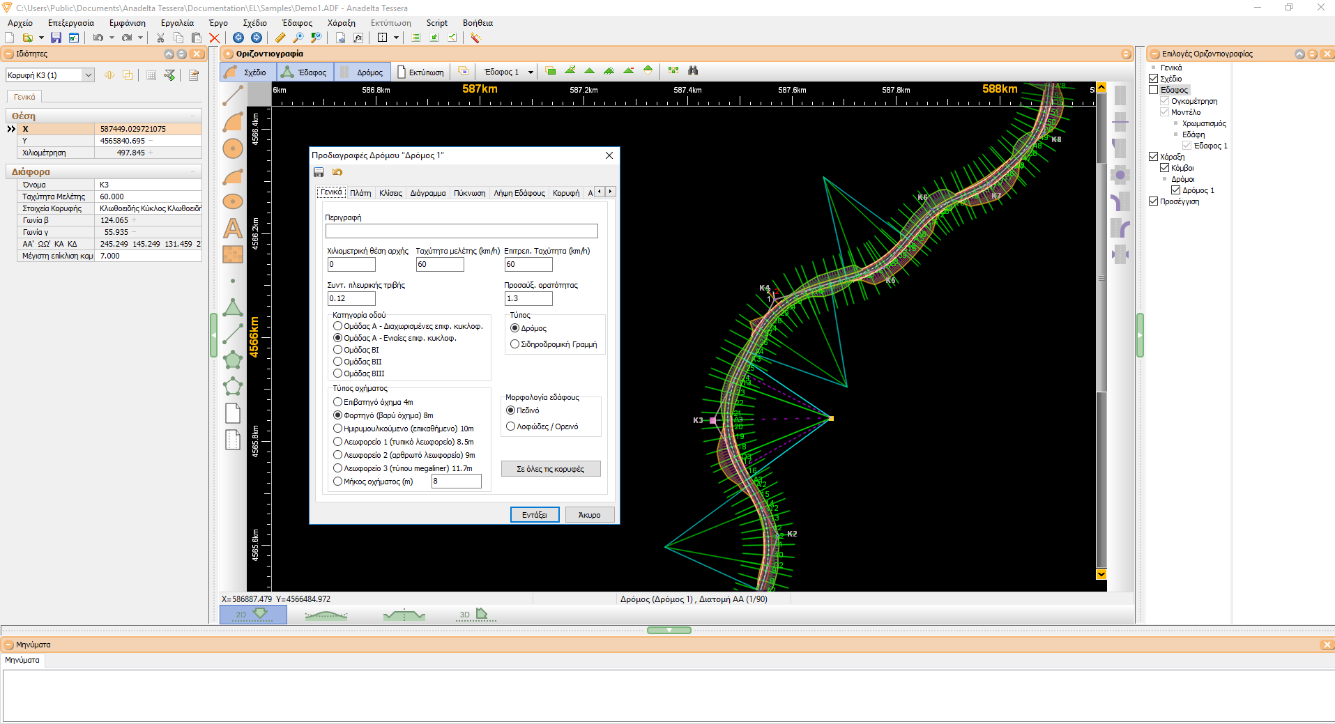
Transition curves
Every road vertex is a composite object consisting of a set of properties such as its coordinates, name, superelevation rate at the bend and type of transition (clothoid-circle-clothoid, parabola-circle-parabola, etc). For every structural element mentioned above, the program suggests default values (radii, lengths or spiral constants) as well as range limits.
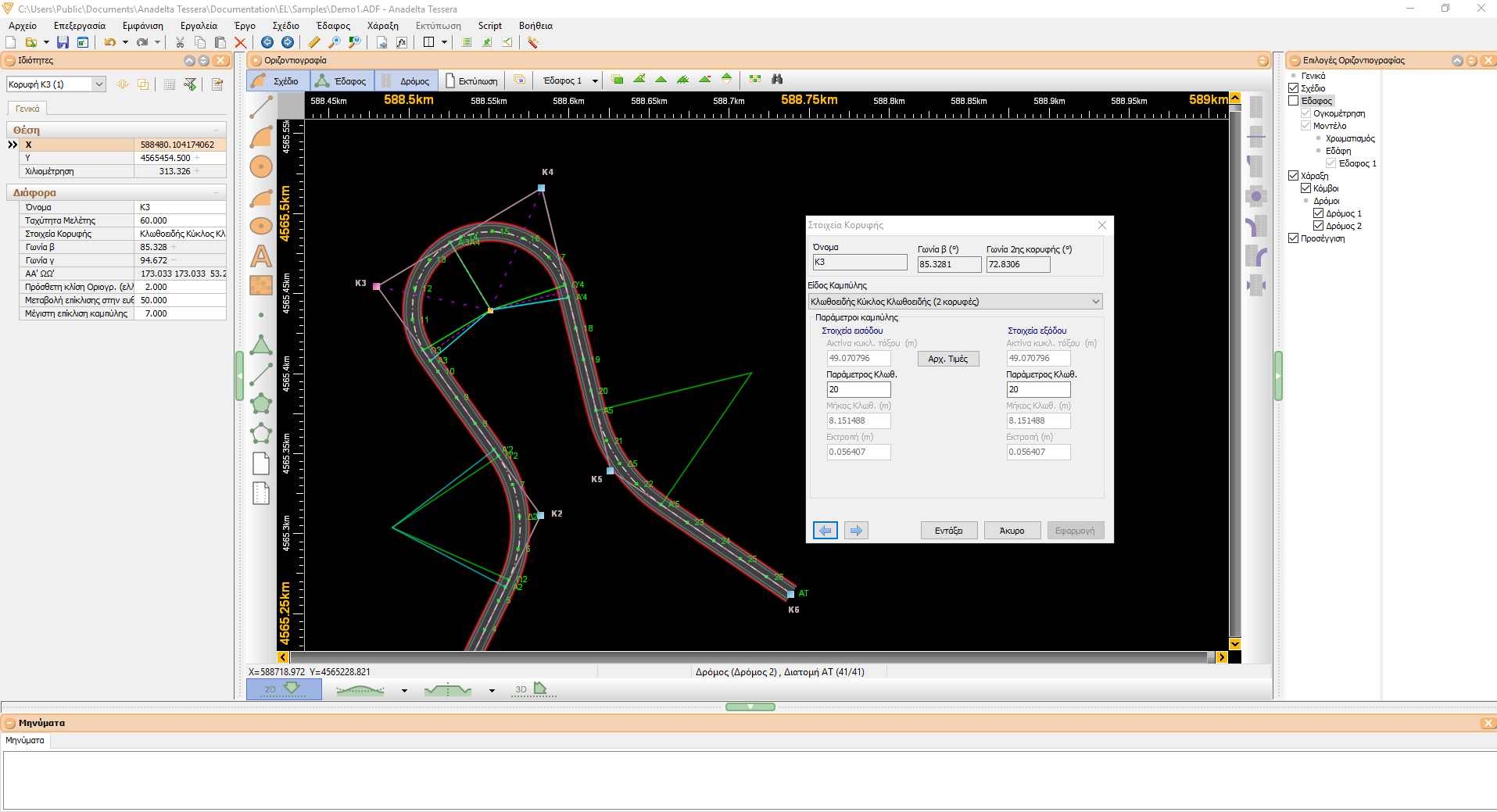
Vertex conjunction - composite curves
Composite curves can be constructed by joining two consecutive road vertices, which the program can then manage as a single object. This category includes the hairpin bend and the sequence clothoid-arc-clothoid-arc-clothoid. In that case the program calculates all the parameter values which the user can then modify at will. If the user chooses to edit a parameter, Tessera recalculates the rest in order to produce the unique solution. This also applies during the visual editing of composite bends. This on-the-fly calculation of the central clothoid is a very useful tool.
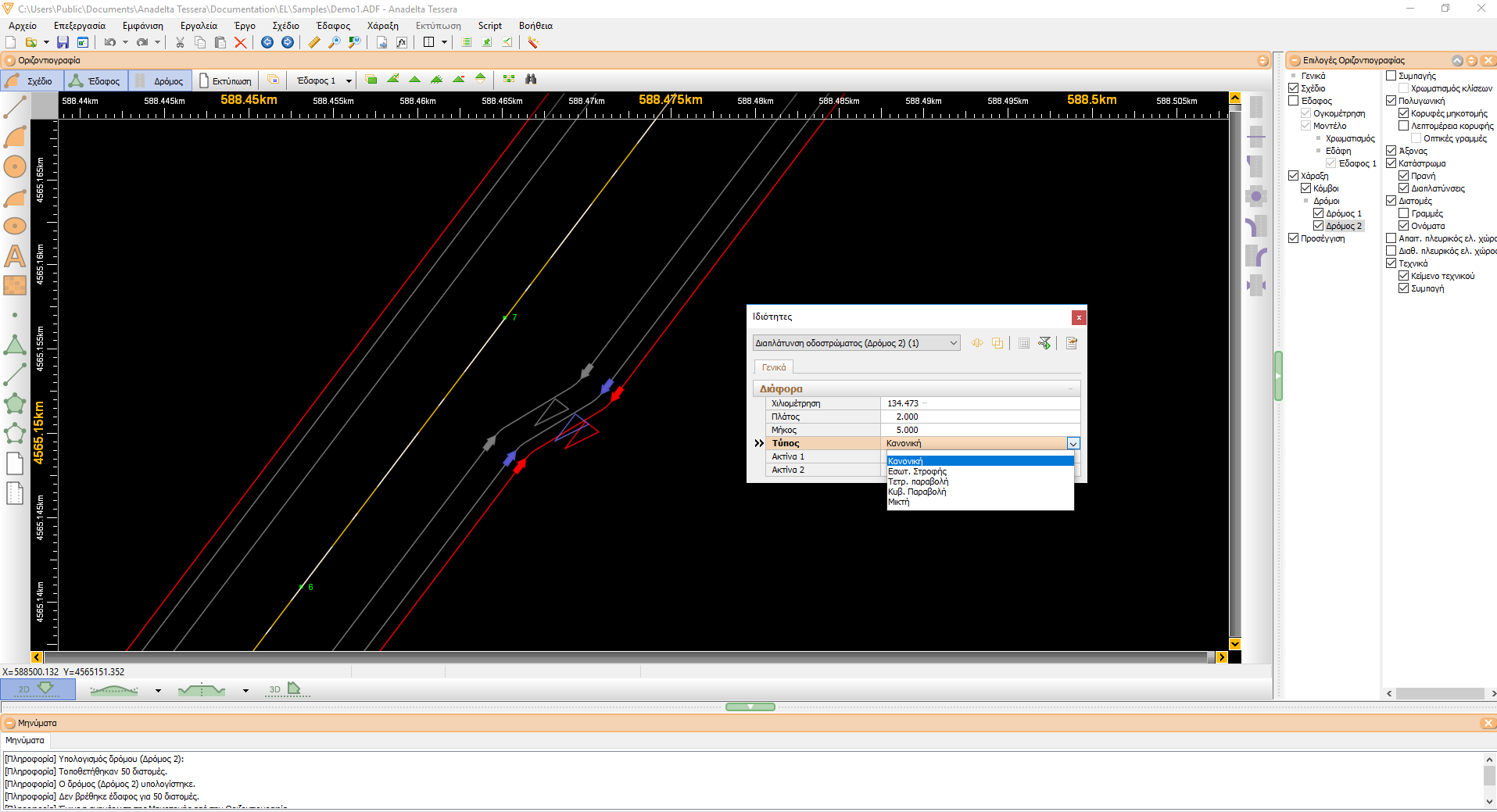
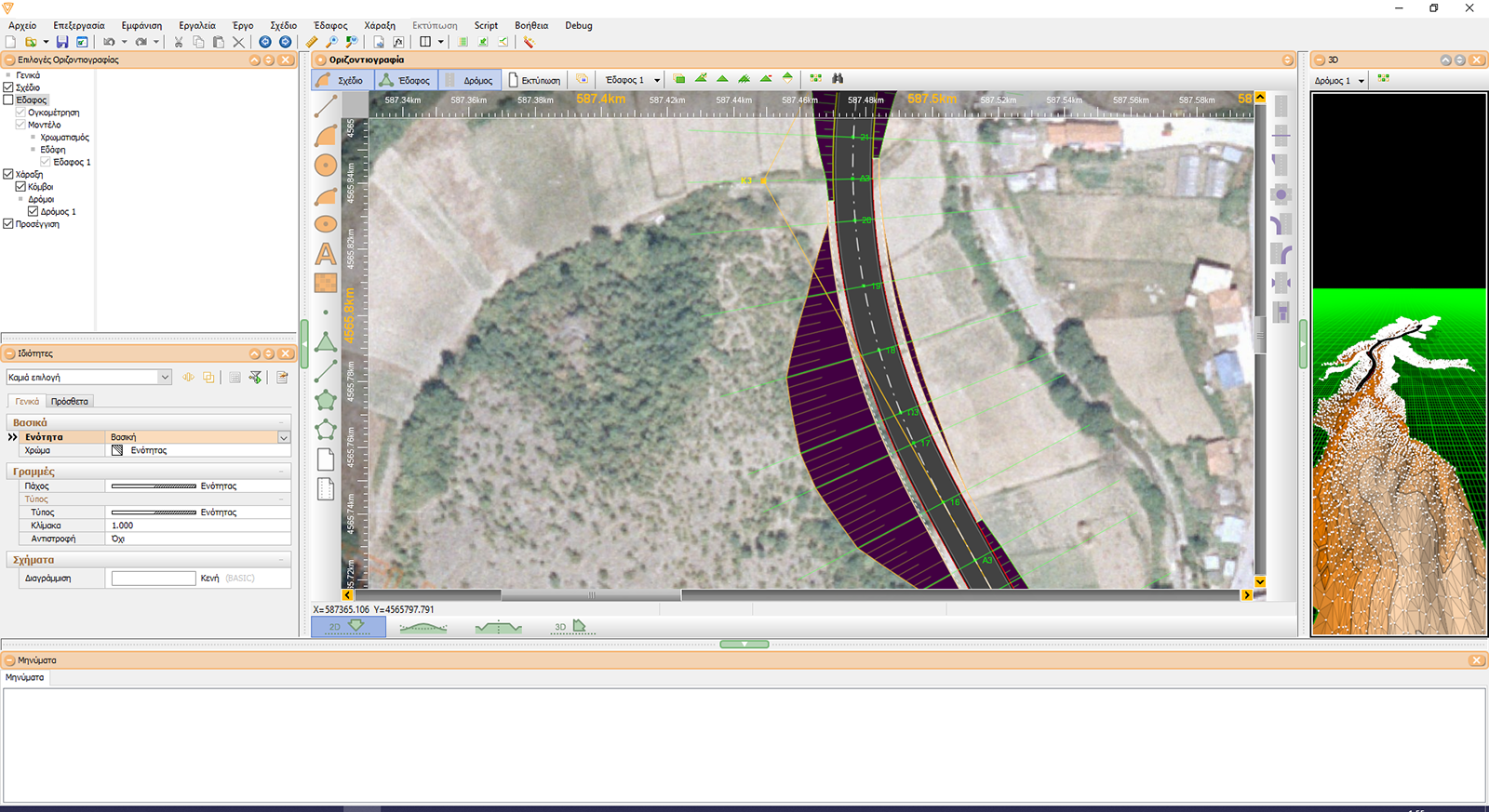
Sidelines - Widenings
Tessera displays the road sidelines according to the initial widths of the carriageway, shoulders and any islands specified by the user. The user can visually modify the carriageway or the roadway width at any position along the road. Such widening or narrowing is an intrinsic property of all sidelines, which means that it is persistent with respect to any changes of the road axis. The real-time update of the road geometry during visual editing allows for an easy adjustment to the terrain layout. The program supports an extensive array of widening functions (e.g. widenings on bends, linear and cubic parabola widenings etc). They can be used for modifying the width of any road surface. Depending on the type of the function, the user can specify the width, length, or curvature radii.
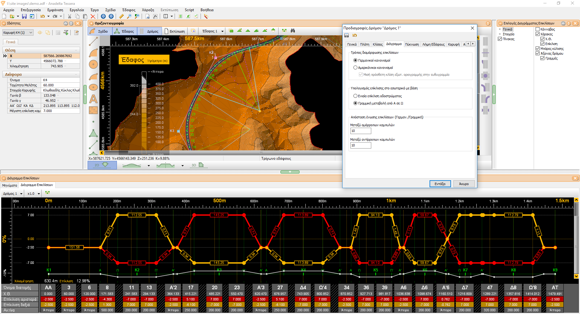
Superelevation rates
The road superelevation rates are displayed on a diagram along with a lot of additional information (curvature diagram, road bend cardinal points). On this subject, both the German (RAS) as well as the American (AASHTO) regulations are supported. Although the superelevation rate calculations are highly parametric, a diagram can be created by simply importing the relevant data from ASCII files. The user can define the superelevation rates along the road straights and the circular arcs, the limits of all supplemental sideline slopes, as well as other parameters such as the application threshold between any two consecutive bends with opposite direction. Any parameter modification is instantly reflected on the graphical representation of the diagram. In the same manner, the user can modify any aspect of the road geometry that the superelevation rates diagram depends on and immediately view the results.
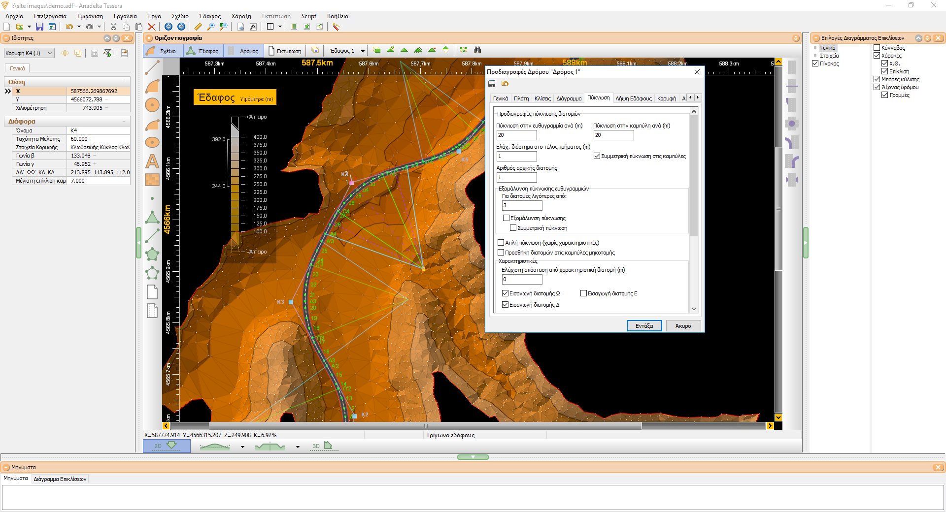
Cross section setting out
The cross sections are placed along the road according to user-specified parameters. The program offers a variety of alternative methods concerning cross section placing. In addition to the distance between cross sections on road straights and bends, the minimum distances at the end of each structural element as well as from cardinal cross sections can be defined. The definition of characteristic cross sections is optional. The program can also automatically adjust the cross section placing in order to better match the underlying terrain structure or to make it piecewise symmetrical. After each modification to the corridor plan, all cross sections are updated accordingly. Additionally, the user can visually place new cross sections as well as move existing ones to a specific position along the road axis. Finally, the positions and the names of all cross sections can be imported from external files of various types.
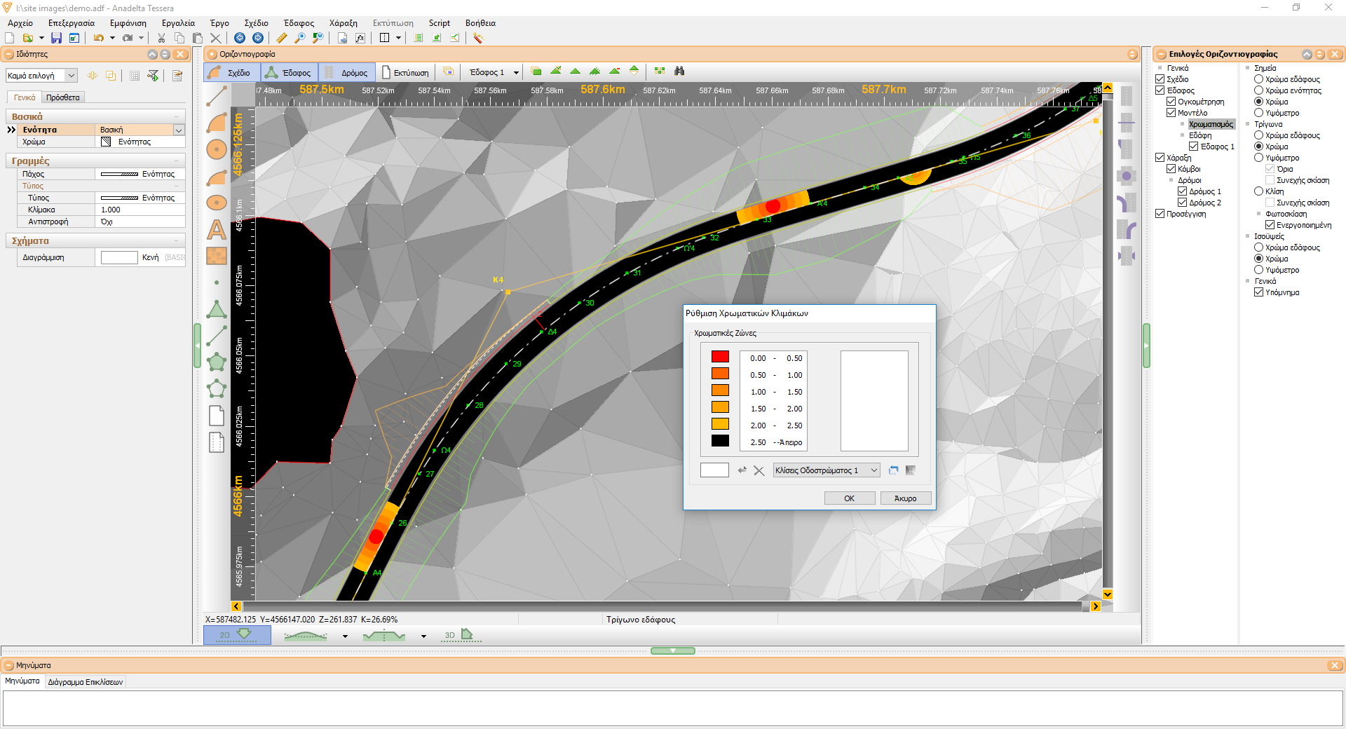
Drainage inspection
After completing defining the Horizontal and Vertical alignment and fine- tuning the superelevation diagram, Tessera can calculate and display the rainwater drainage rate throughout the road surface. The user can specify a color scale that will be used for this purpose. In that way the problematic drainage areas can be identified and corrected.
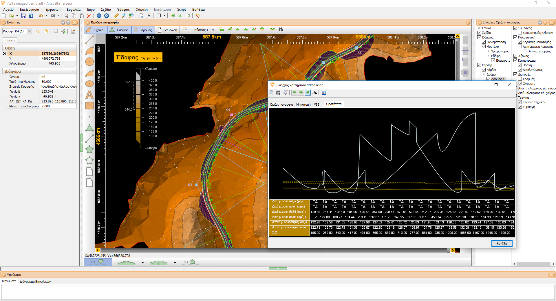
Visibility
Tessera can calculate the required visibility distance according to the per-element calculated V85 speed. Based on this quantity it can compute the required roadside space and draw the visibility curves. In addition, when the existing space is smaller than required it can automatically apply any modifications needed to improve visibility. Finally the existing sight distances according to the Horizontal and Vertical alignment can be determined and a report can be produced separately for each direction, along with the percentage of the road for which the existing visibility range is larger by a factor than required.
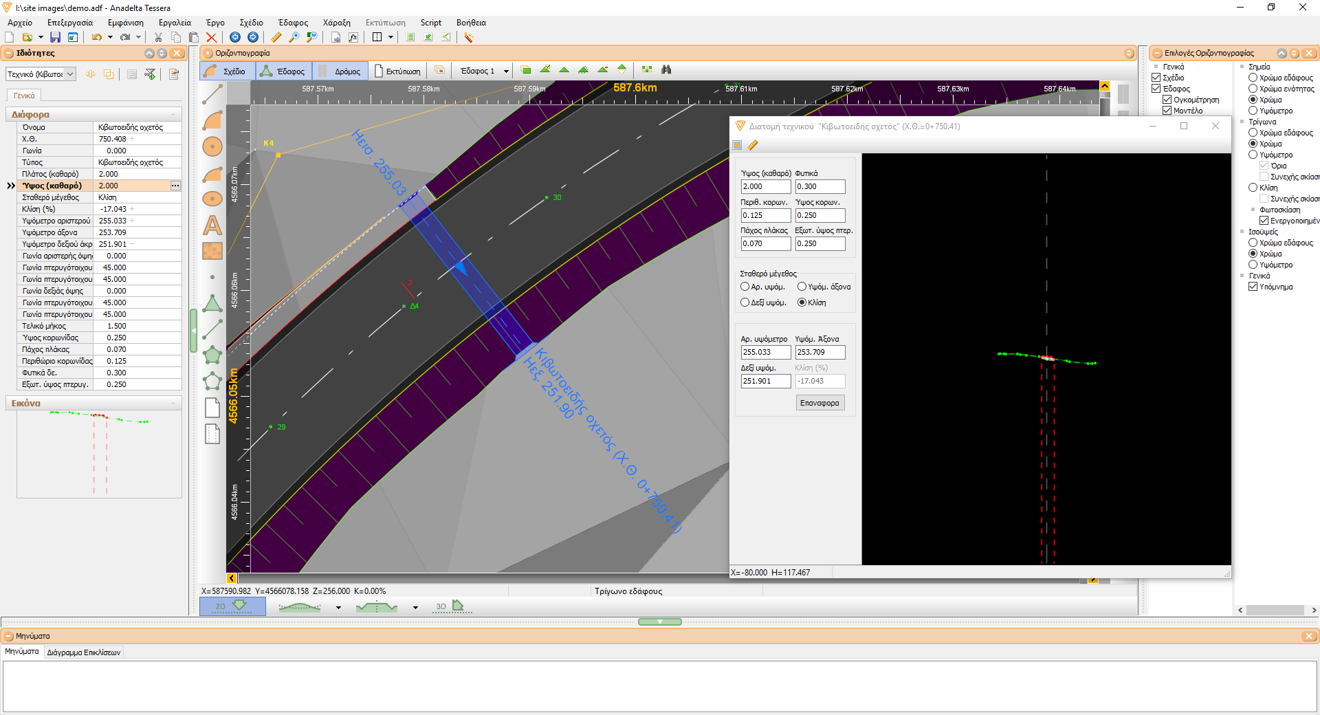
Structures
Tessera greatly simplifies structure creation and insertion. A structure can be defined either by typing its parameters, or graphically by using the mouse. Its type, position, dimensions, axis of orientation, sides and wing walls are fully customizable. Structures can be inserted while working either in the Horizontal Alignment or the Profile workspace. Upon its creation, all other views will be automatically updated.
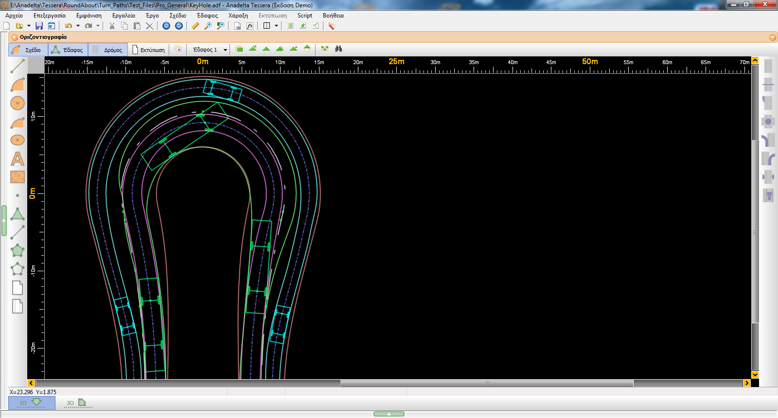
Swept Path Analysis
Tessera can calculate vehicle path separately for each lane of the road. There is a library of floor plans and profiles of multiple vehicle types, while it is possible to create new ones by copying and modifying. Also, it is feasible to use a different type of vehicle for each lane and graphically move and insert a vehicle in any position, performing a simulation.
Orthophotos via WMS server
The program is capable of downloading orthophotos directly from WMS server, either as an automatically updated background or as a single image.