

Terrain
Explore Anadelta Tessera's terrain modeling tools, supporting both TIN (points, triangles) and DEM (digital elevation models). Accurate terrain input is essential for precise road design.
Overview
Tessera includes an advanced terrain triangulation and processing subsystem. The program's native support for Triangulated Irregular Networks (TINs) goes beyond simple representation or query capabilities. Tessera TINs are fully interactive data structures which can be freely modified and can interface with the other parts of the CAD platform. Multiple TINs are supported per project, each with its own parameters and rendering options. The user also has the ability to exchange data or perform volumetric operations between them.
Terrain Data Input
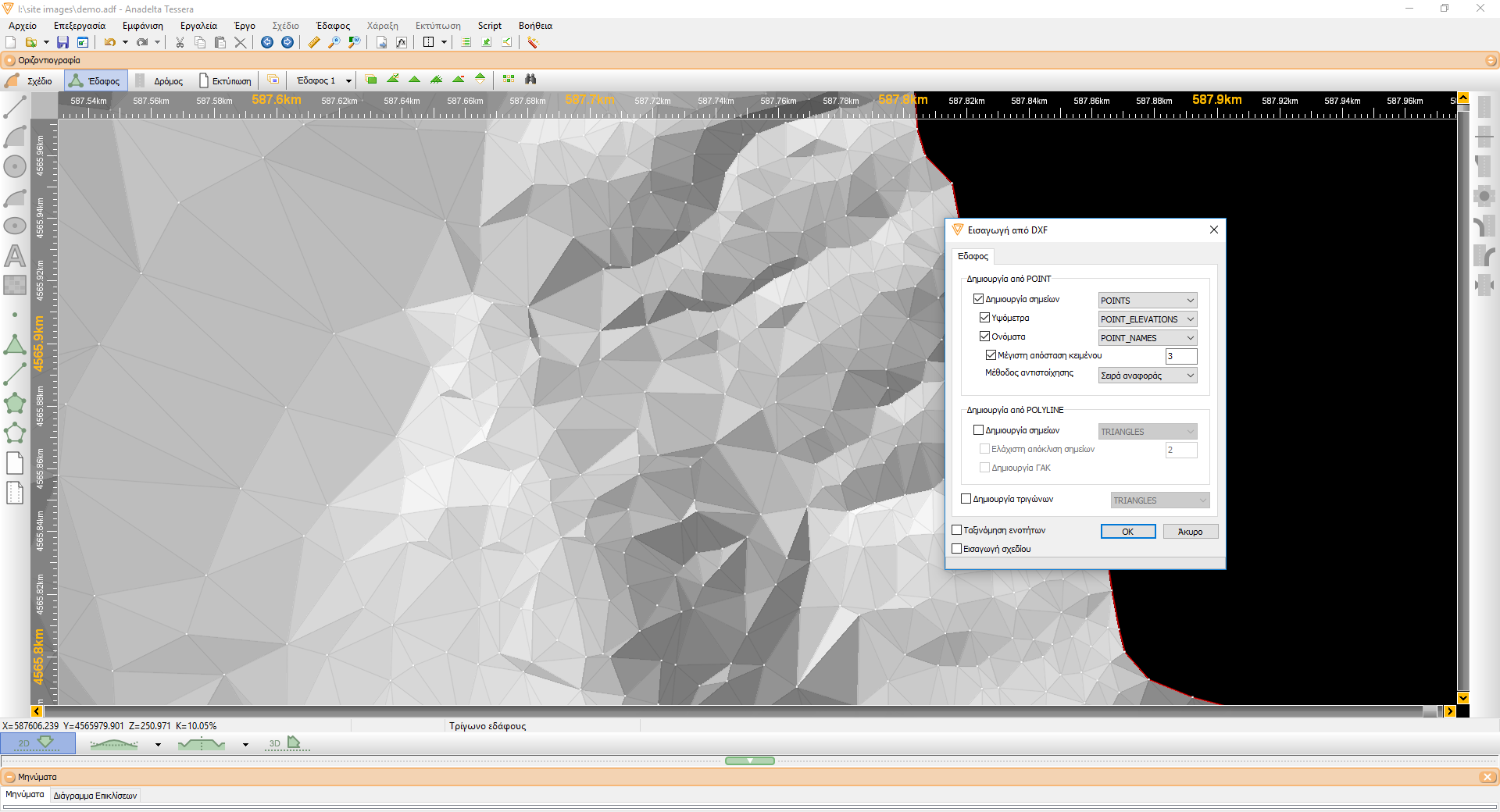
Terrain elements (points, triangles and breaklines) can be imported either from ASCII or from DXF files. In the latter case, the program facilitates the procedure by analyzing the file and suggesting input layers for each type of element. After importing, a thorough and exhaustive terrain structural and geometric consistency check can be performed. The user can thus pinpoint and correct problematic areas (e.g. duplicate points, inconsistent terrain structure, intersecting breaklines, etc).
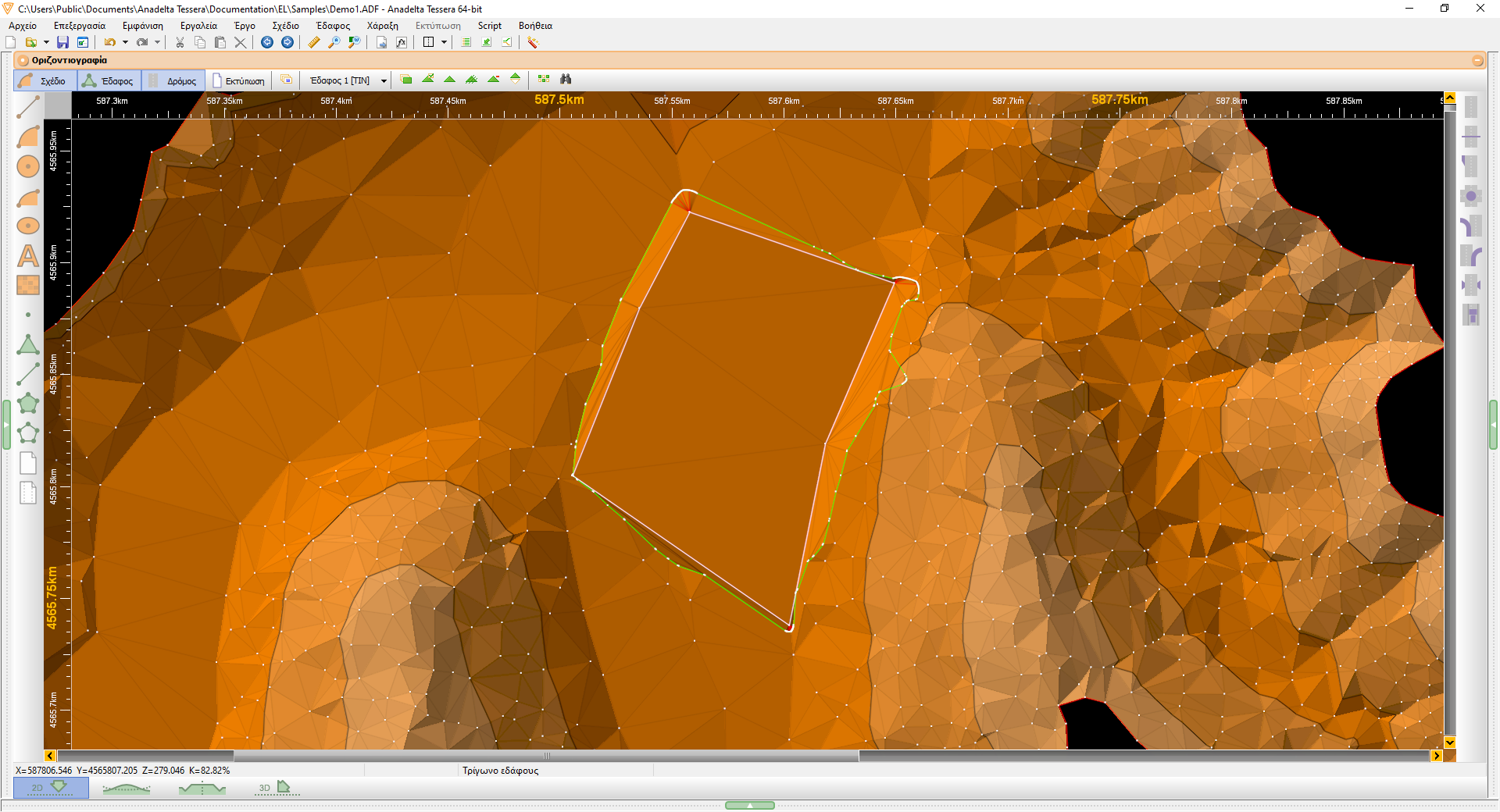
Breaklines and boundaries definition
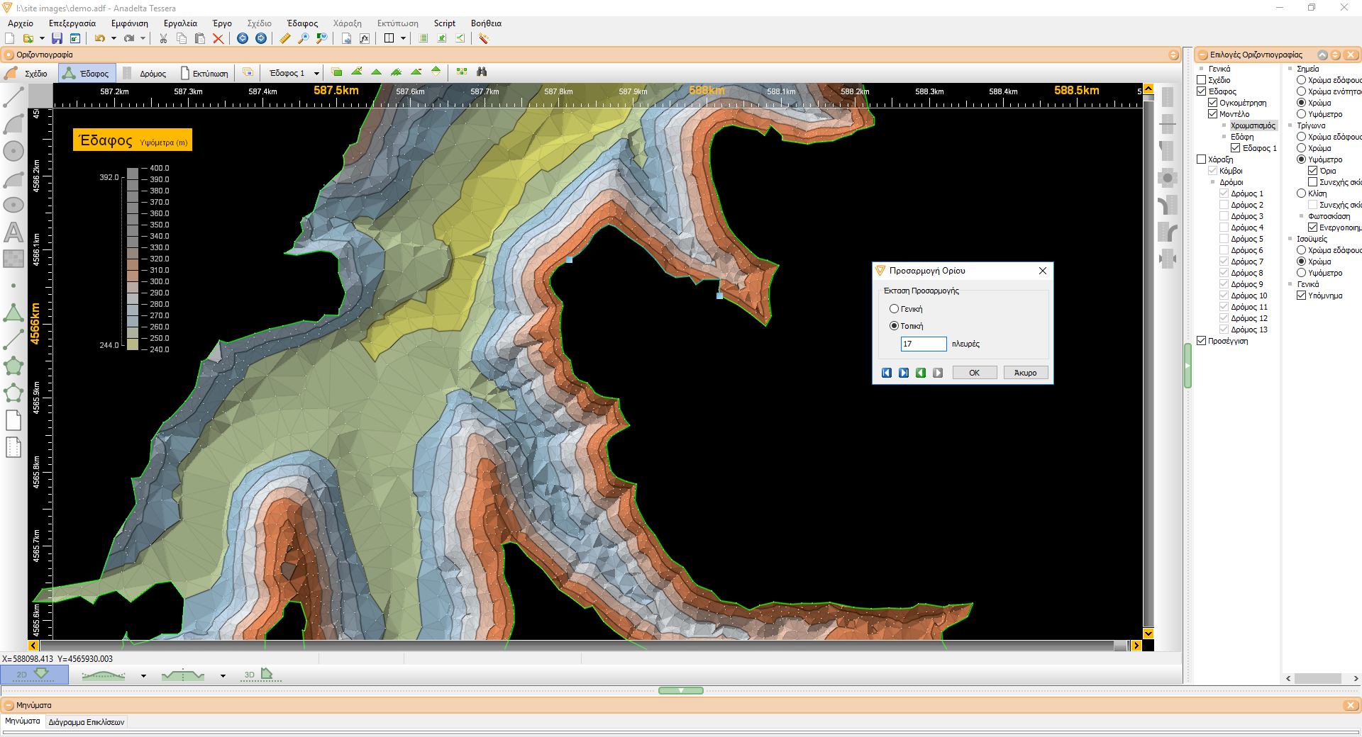
Breaklines can be inserted by the user even on an existing triangulation, which is instantly recomputed on a local basis. This feature, combined with the program's relief shading capabilities, allows for an easy and exact TIN definition procedure that leads to a faithful representation of the original terrain structure. In addition, triangulation and computation boundaries can be effortlessly inserted by using an intuitive silhouette-adjustment method.
Triangulation
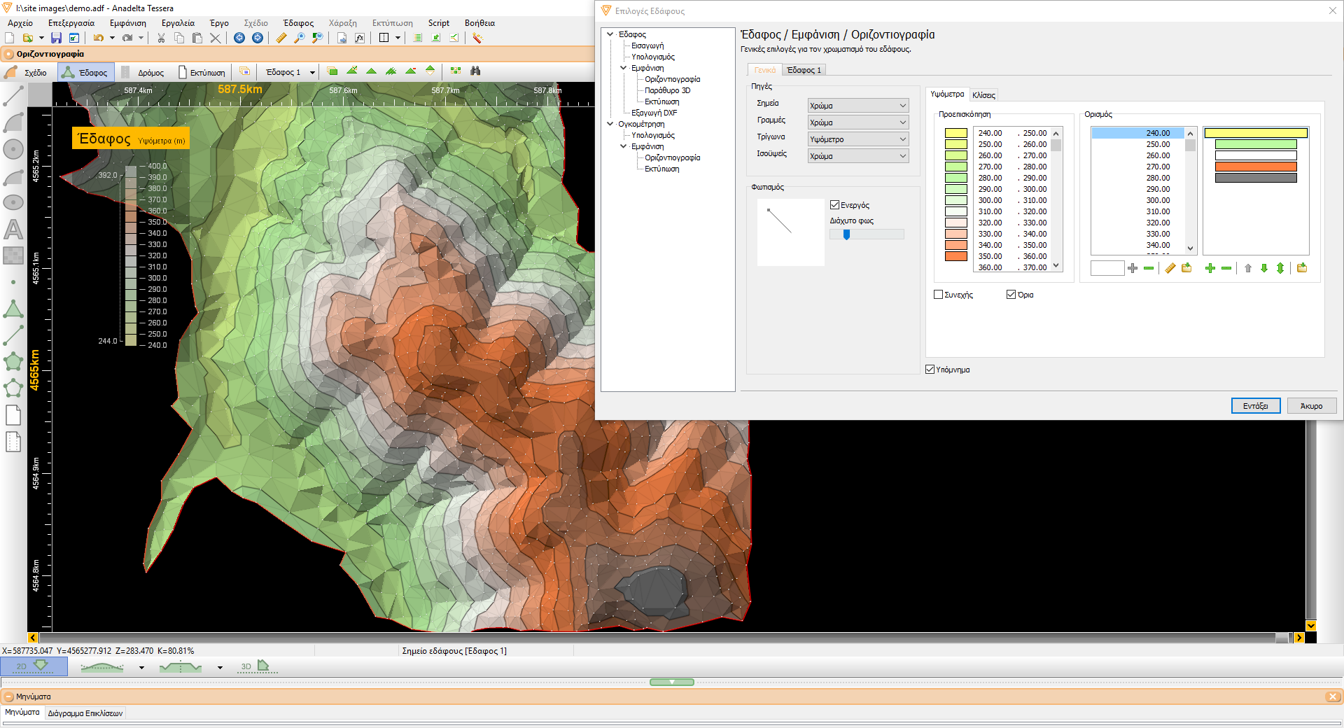
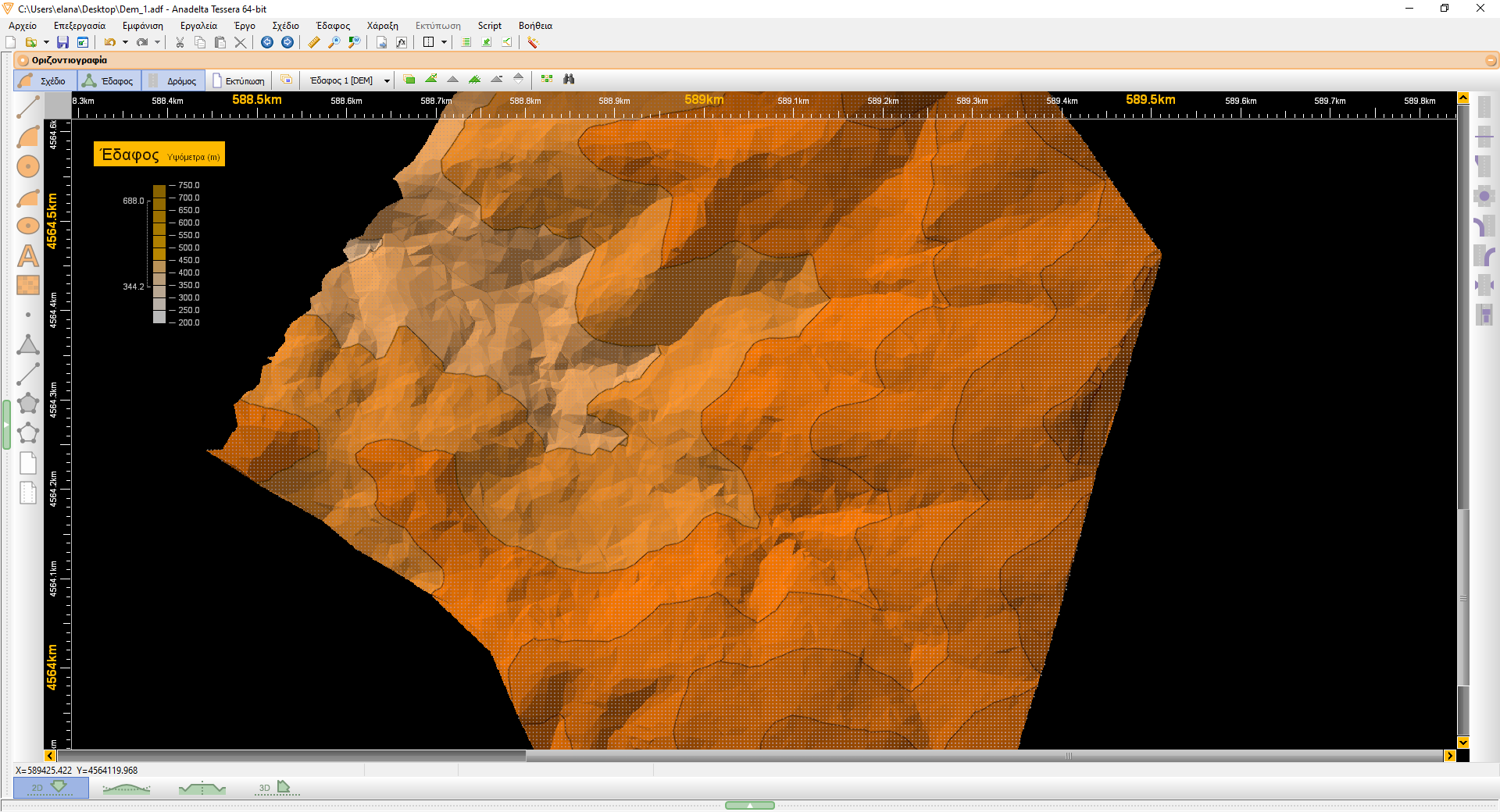
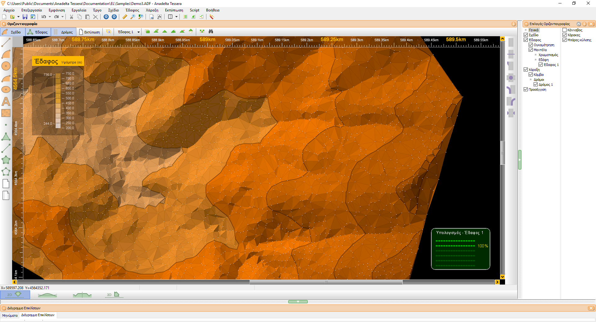
The actual triangle calculation is very fast (an entry-level computer can process TINs consisting of hundreds of thousands of points as well as breaklines within seconds). The algorithm operates in linear time with respect to the number of triangles on the average case. The resulting triangulation satisfies the Delaunay criterion (i.e. the minimum angle is maximized) thus producing high-quality meshes. However, the user can always choose to modify any triangles if this is deemed necessary. The terrain can be at all times shaded by a light source and colored according to elevation or slope, thus revealing its three dimensional structure. This can make the process of correcting triangles a very easy and efficient procedure. In addition, contours are instantly calculated and can be displayed either as polylines or as cubic Bezier splines with a smoothness factor defined by the user.
Wind Turbine Foundation
The latest version of Tessera Professional includes the ability to create new terrains with slopes for wind turbine foundations. Its slopes can be easily configured and the earthwork (cuttings and fillings) of the wind turbine foundation can be calculated.