

Benefits of the Professional
Tessera Pro is the professional edition of Anadelta's road design software, offering multiple advanced features.
Multiple terrain models
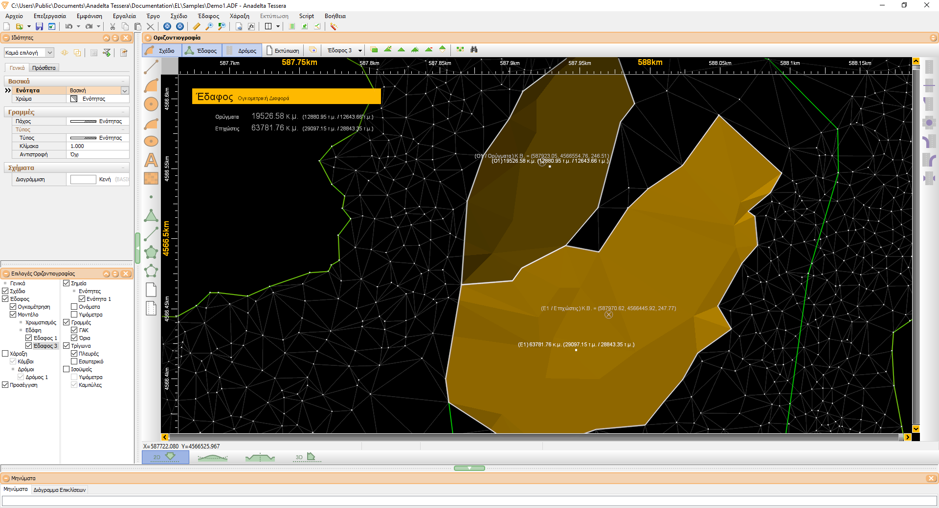
Tessera supports the coexistence of many TINs in the same project. Each TIN can represent a different layer or even a set of points without elevation data (which we may wish to subsequently retrieve from a separate triangulation). Every terrain object has its own computational parameters (e.g. elevation range, contour dimension, breakline insertion, maximum triangle side length), as well as rendering settings (wireframe, relief shaded, colored, etc). Tessera can also calculate the exact volumetric difference between two terrain objects or between an object and a user-defined plane.
Wider range of transition curves - Composite curves
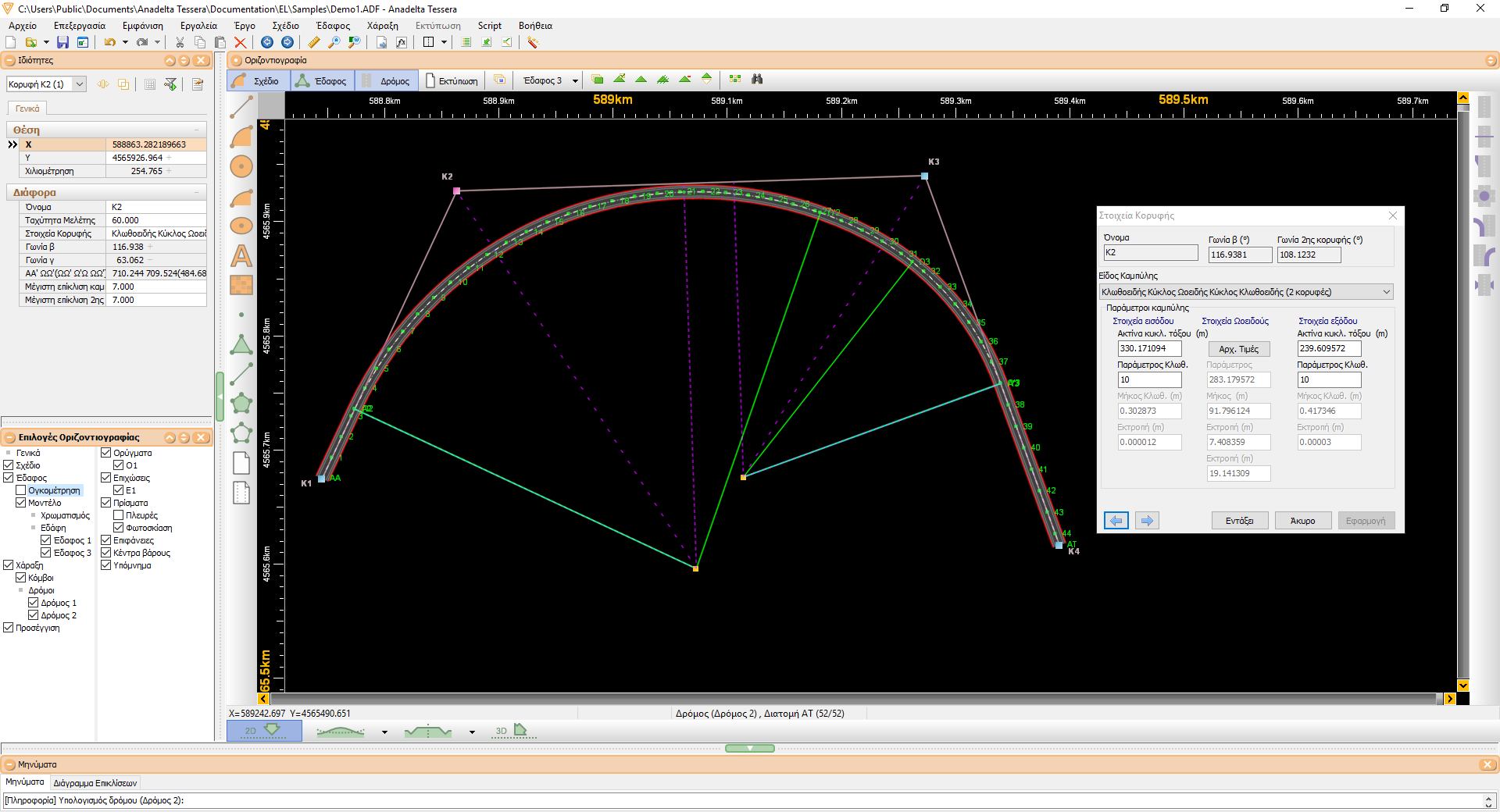
In addition to the standard transition curves used in road construction, such as circle-clothoid-circle, the Professional Edition offers parabola curves, tailored specifically for railroad planning, as well as more complex compositions (clothoid-arc-clothoid-arc-clothoid, etc.). Tessera will automatically calculate values for all curve parameters in order to produce a solution. The user can choose to modify any of the suggested values, in which case the software will adjust the other inputs accordingly. This can also be done in real-time, while the user graphically moves any of the two bracketing PIs with the mouse. The calculation of especially the egg-shaped curve while a road PI is being moved in real-time is a very useful tool.
Intersections
The Professional edition of Tessera suppports the automatic insertion and management of intersections. Their specifications include all the design parameters for left-turn lanes, decceleration lanes, central medians, isolation zones, channelizing islands and triangular entry and exit islands. Modifying any parameter (length, width, radius, calculation method, etc.) either by keyboard entry, or visually by using the mouse, will automatically lead to a complete recalculation of the entire structure. At the same time, descriptive information messages (or warnings when appropriate) will be produced and displayed. Every recalculation is followed by the automatic update of all elements related to elevation, width and slope transitions. After cross section calculation all intersection sidelines and sideslopes are drawn.
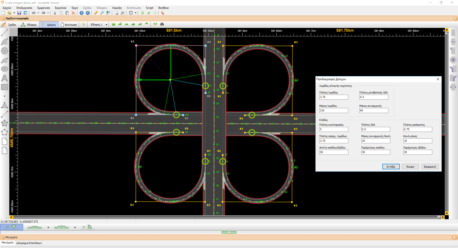
Roundabouts - NEW
Tessera Pro provides specialized functionality for the analysis and design of roundabouts, fully integrated within the project environment. The designer can parametrically define the geometry of the circular road and configure the entry and exit approaches. The software also includes an automated tool for the vertical design and elevation modeling of the roundabout. Advanced geometry checks and built-in automation significantly accelerate the design process, reduce the need for manual interventions, and provide greater control over both the horizontal alignment and vertical design of roundabouts.

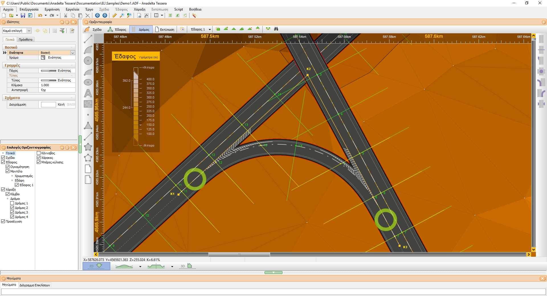
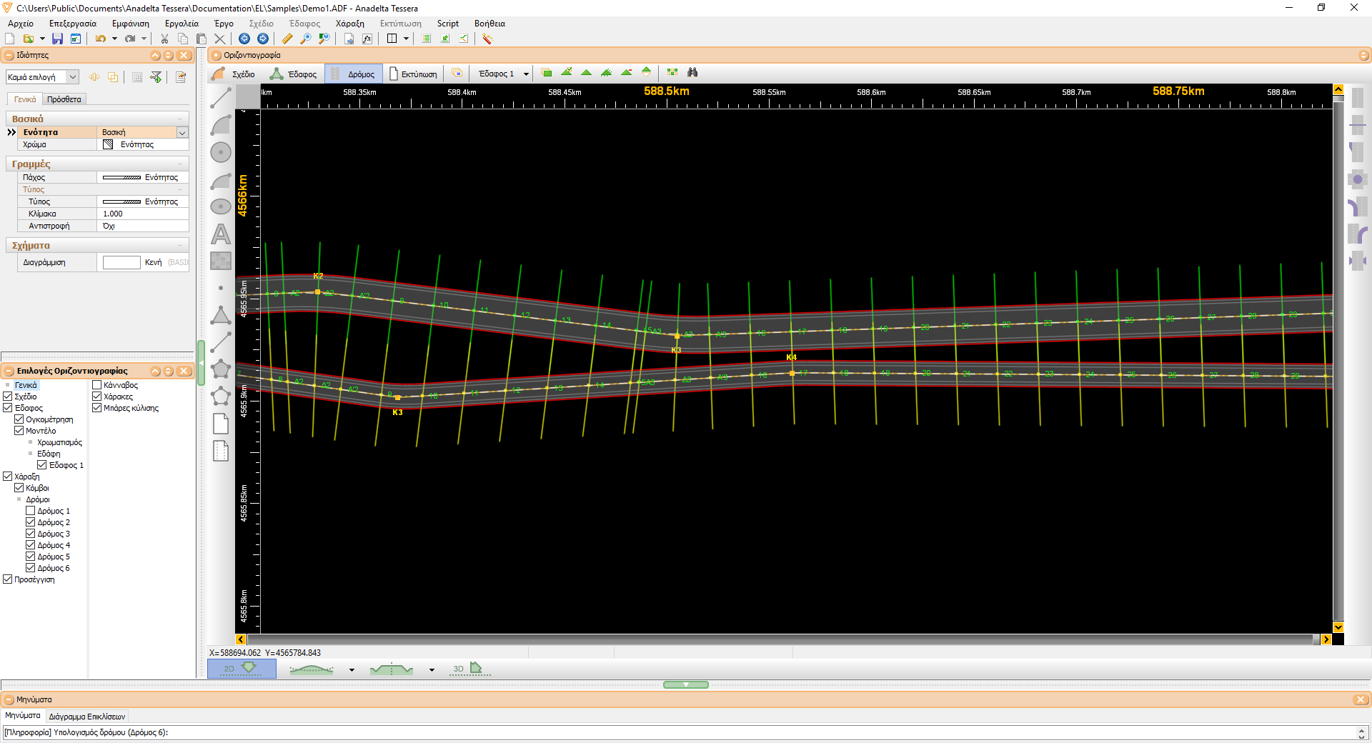
Interchanges - Divergences / Convergences
The easy, user-friendly automatic creation of interchanges is one of Tessera's strong points. The user can insert a new convergence or divergence via a multitude of methods. Acceleration lanes can be automatically inserted. For each converge or divergence, Tessera selects the appropriate auxiliary lane configuration parameters (width, length, length of transition curve), entry / exit angles as well as the characteristics of all relevant branches (widths, curvature radii, transition lengths) by consulting the specifications provided by the user. The software can perform automatic main road / branch cross section synchronization, as well as width, superelevation and profile elevation adjustments. Finally, composite cross sections can be created when necessary at area of the interchange.
Interchanges - Loops, Direct ramps, etc.
By combining divergence and convergence elements, connective branches of any kind and geometrical shape can be constructed between two roads. In addition, based on user preference, Tessera can also insert loops and direct ramps in the crossing areas between two roads. There is also the capability of merging two branches into a unified road, which can in turn intersect a third road, coming either from the same or from a different elevation, like in a trumpet interchange. Once again, all connective branches, no matter how they have been inserted, can be modified either by changing their parameters in the interchange specifications table, or visually by using the mouse. Any modifications are followed by superelevation and profile adjustments.
Service roads
Tessera offers the capability to create a new road by means of copying and transforming the geometric structure of an existing one. This feature greatly facilitates the design and layout of service roads. After a service road has been created, it can be independently modified, diverted or generally edited in any way. However, the cross sections of a service road can be designated as extensions of the respective cross sections of the main road. More importantly, this feature can be used on a per segment basis and any road can serve as the main road. This capability comes in handy for setting the branch road cross sections on intersections.
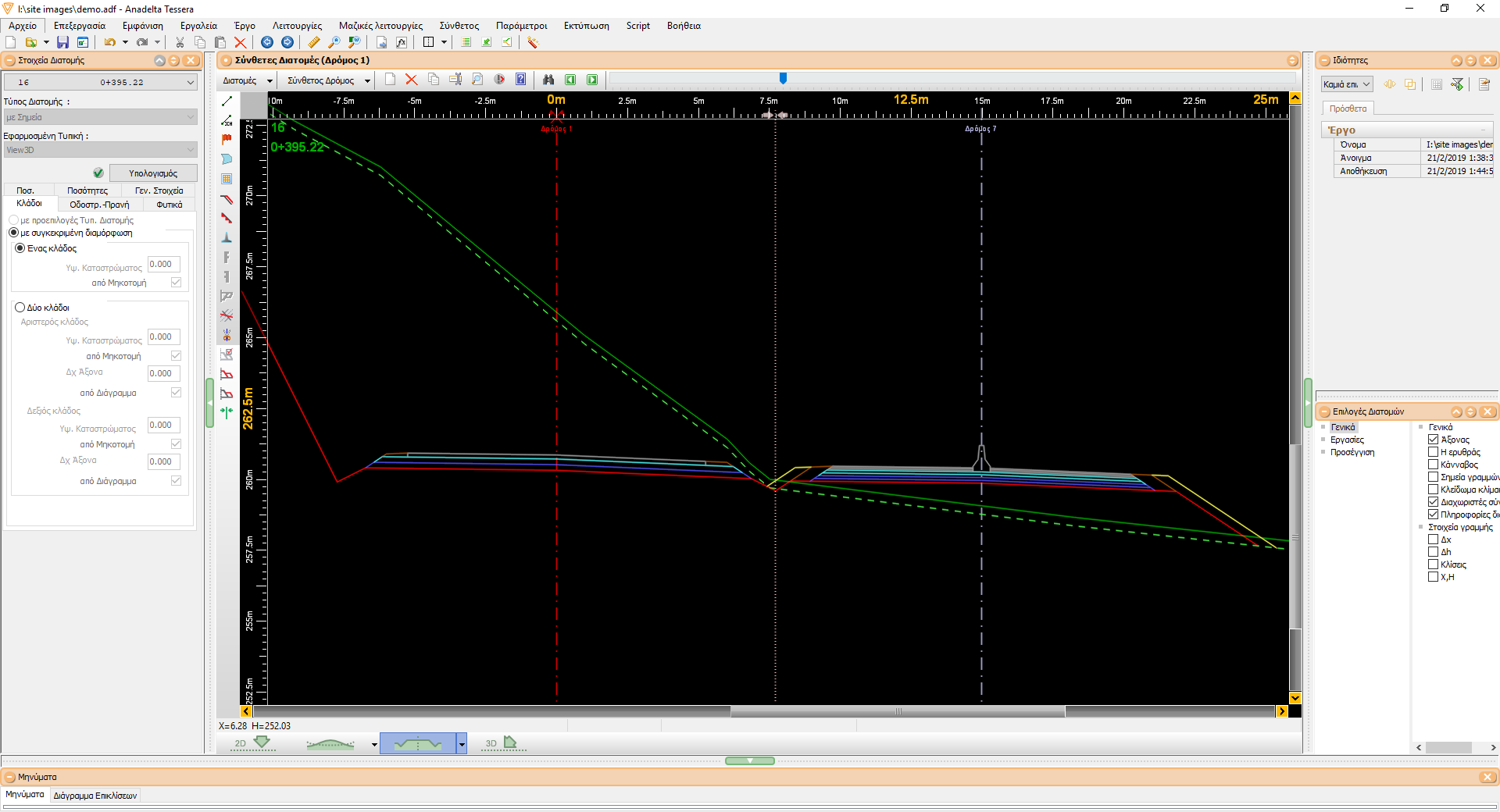
Composite cross sections
Creating composite cross sections along the entire road is something that can be done easily and efficiently with Tessera. After creating and editing the cross sections for each road independently, the composite road's cross sections are automatically created. The user can specify the road calculation order, as well as choose between creating a single, unified artificial ground or multiple ones. After this stage, the composite road can be treated as a simple one, which means that all processing, editing and printing functions are supported. This includes every drawing as well as the mass table. Finally, the constituent roads' cross sections can be retro-actively updated so that the Horizontal Alignment workspace can be kept synchronized.
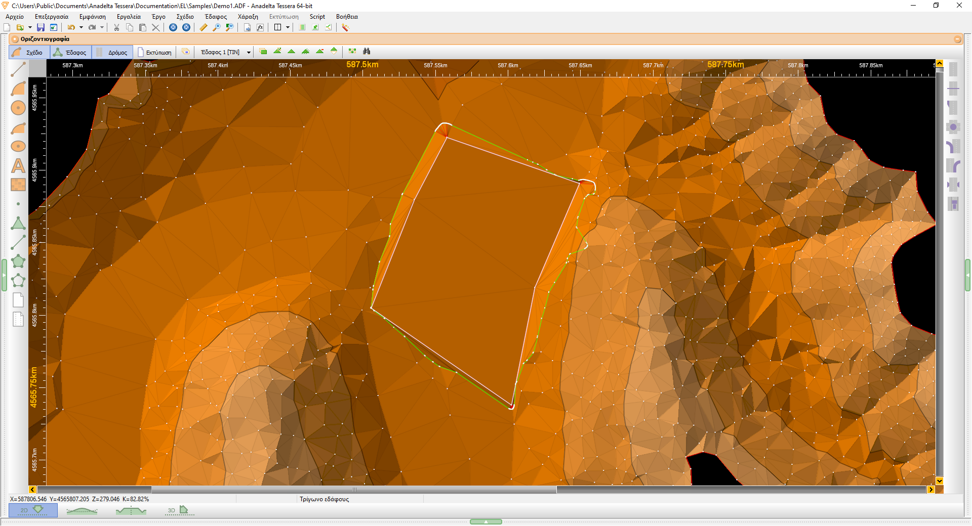
Wind Turbine Foundation
Tessera Professional includes the ability to create new terrains with slopes for wind turbine foundations. Its slopes can be easily configured and the earthwork (cuttings and fillings) of the wind turbine foundation can be calculated.