

Δυνατότητες της Professional
Πολλά μοντέλα εδάφους - όγκοι
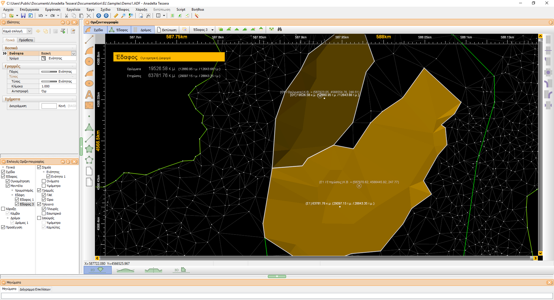
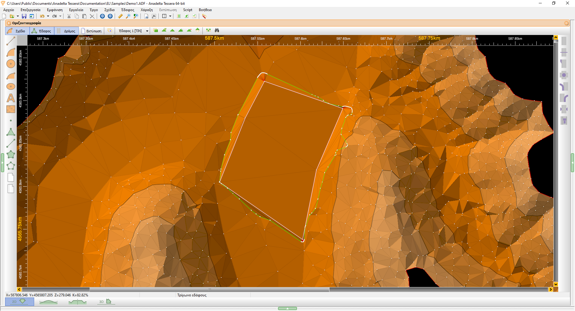
Η έκδοση Professional του Tessera υποστηρίζει τη συνύπαρξη πολλών εδαφών. Το κάθε έδαφος μπορεί να είναι ένα διαφορετικό επίπεδο ή ένα διαφορετικό σύνολο σημείων χωρίς υψόμετρα που θέλουμε την προσαρμογή του σε ένα άλλο μοντέλο εδάφους. Όλα τα εδάφη διαθέτουν τα δικά τους ιδιαίτερα χαρακτηριστικά υπολογισμού (υψομετρικά όρια, ισοδιάσταση, γραμμές αλλαγής κλίσης, μέγιστο μήκος πλευράς τριγώνου) και εμφάνισης (πλέγμα, φωτοσκίαση, κλπ). Το πρόγραμμα υπολογίζει ογκομετρικές διαφορές μεταξύ τους και τις παριστάνει με διάφορα χρώματα (επιχώματα, ορύγματα, αμετάβλητο). Υπολογίζει επίσης ογκομετρικές διαφορές μεταξύ ενός εδάφους και ενός επιπέδου, που ορίζεται από το χρήστη.
Καμπύλες συναρμογής - Σύνθετες καμπύλες
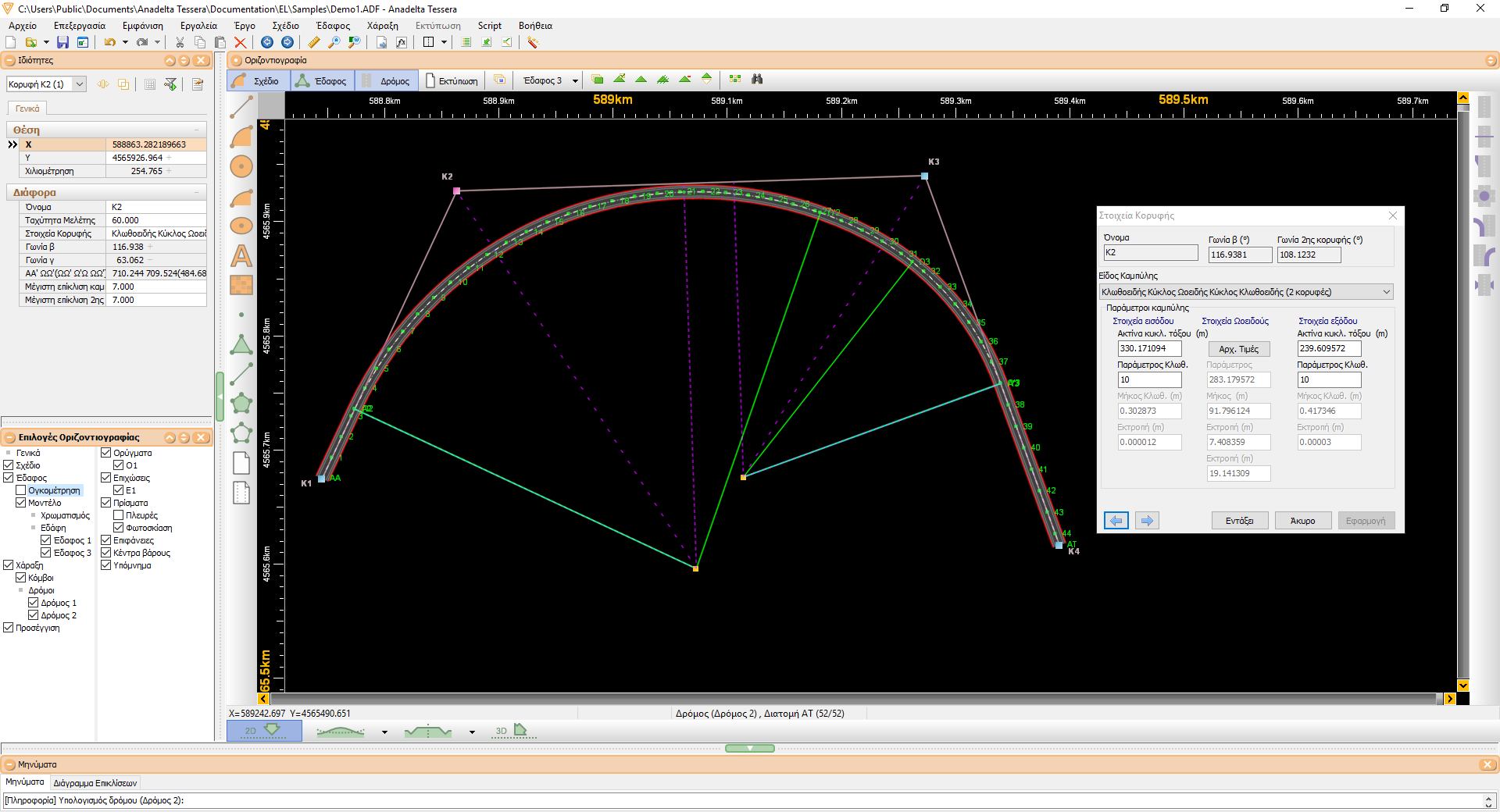
Οι επιπλέον ακολουθίες δομικών στοιχείων κορυφών στην έκδοση Professional είναι οι παραβολή - κυκλικό τόξο - παραβολή (3ου και 4ου βαθμού) και κλωθοειδής - κυκλικό τόξο - ωοειδής - κυκλικό τόξο - κλωθοειδής που προκύπτει από τη σύζευξη δύο διαδοχικών κορυφών. Το πρόγραμμα υπολογίζει όλες τις τιμές των παραμέτρων και ο χρήστης έχει τη δυνατότητα να τροποποιήσει κάποιες από αυτές. Υπολογίζονται πάντα οι υπόλοιπες ώστε να υλοποιείται η μοναδική κάθε φορά λύση. Το ίδιο συμβαίνει και στη γραφική μετακίνηση οποιασδήποτε από τις δύο εμπλεκόμενες κορυφές. Ο υπολογισμός της ωοειδούς σε πραγματικό χρόνο, κατά τη διάρκεια μετακίνησης μιας κορυφής είναι ένα πολύ χρήσιμο εργαλείο.
Ισόπεδοι κόμβοι
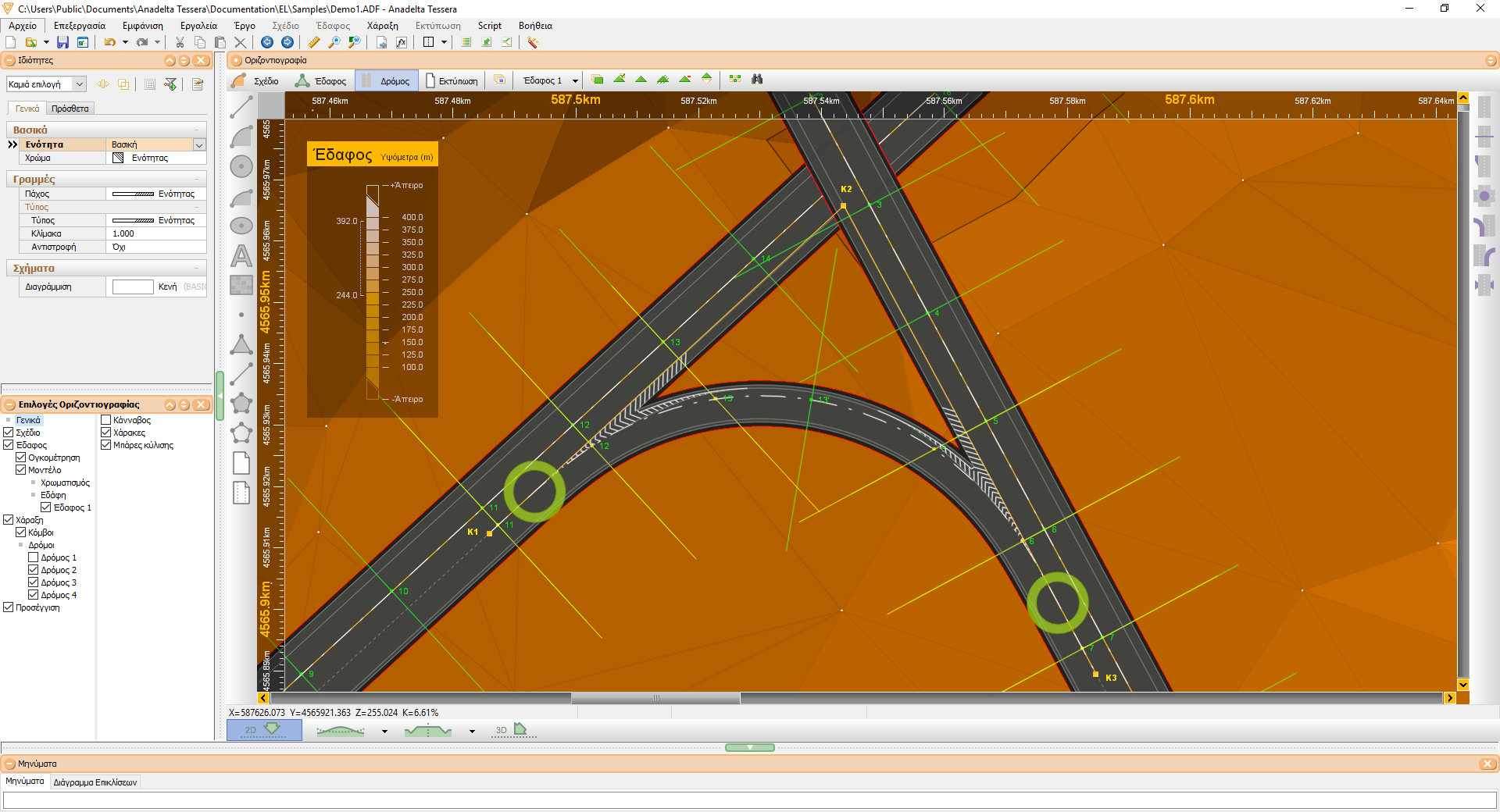
Το Tessera Pro υποστηρίζει την αυτοματοποιημένη εισαγωγή και διαχείριση ισόπεδων κόμβων. Οι προδιαγραφές τους περιλαμβάνουν όλες τις απαιτούμενες παραμέτρους για λωρίδες αριστερής στροφής, λωρίδες επιβράδυνσης, κεντρικές νησίδες, ζώνες αποκλεισμού, σταγόνες, τριγωνικές νησίδες εξόδου και εισόδου. Η μεταβολή οποιασδήποτε παραμέτρου (μήκους, πλάτους, ακτίνας, τρόπου υπολογισμού κλπ.) ή η γραφική μετακίνηση οδηγεί σε αυτόματο επανυπολογισμό της συνολικής δομής, με παράλληλη εμφάνιση επεξηγηματικών μηνυμάτων ή προειδοποιήσεων. Κάθε επανυπολογισμός ακολουθείται από ενημέρωση των απαιτούμενων στοιχείων για την υψομετρική συναρμογή, τη συναρμογή των πλατών και των επικλίσεων. Μετά τον υπολογισμό των διατομών σχεδιάζονται αυτόματα οι οριογραμμές και τα πρανή στην περιοχή του κόμβου.
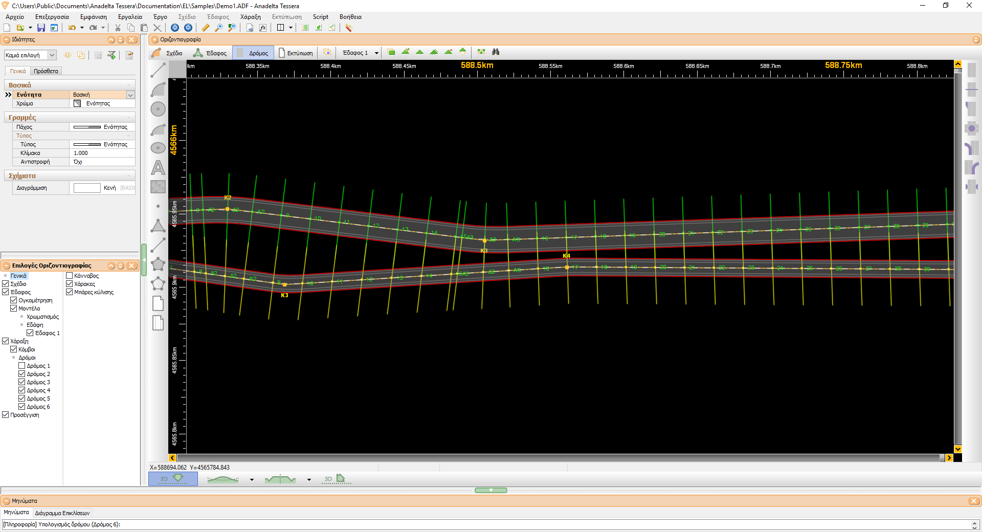
Ανισόπεδοι κόμβοι - Μερισμοί / Συμβολές
Η αυτοματοποιημένη διαχείριση ανισόπεδων κόμβων με πολλούς τρόπους εισαγωγής μερισμών και συμβολών και αυτόματη εισαγωγή των λωρίδων επιτάχυνσης ή επιβράδυνσης είναι ένα από τα δυνατά σημεία του Tessera. Για κάθε μερισμό ή συμβολή επιλέγονται από τις προδιαγραφές κόμβων τα χαρακτηριστικά των λωρίδων αλλαγής ταχύτητας (πλάτος, μήκος, μήκος συναρμογής), οι γωνίες εισόδου / εξόδου καθώς και τα χαρακτηριστικά των σχετικών κλάδων (πλάτη, ακτίνες καμπυλότητας, παράμετροι, μήκη συναρμογής). Η έκδοση διαθέτει αυτοματοποιημένες λειτουργίες συγχρονισμού των διατομών κύριου δρόμου και κλάδου, προσαρμογής πλατών και επικλίσεων καθώς και υψομετρικής συναρμογής της μηκοτομής των κλάδων. Τέλος δημιουργούνται αυτόματα οι σύνθετες διατομές στις περιοχές των κόμβων.
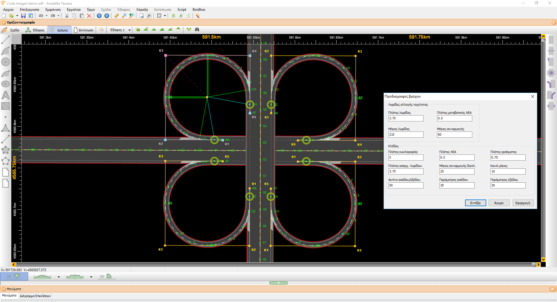
Ανισόπεδοι κόμβοι - Βρόχοι, Απευθείας κλάδοι
Με συνδυασμό μερισμού και συμβολής μπορούν να προκύψουν οποιασδήποτε μορφής και γεωμετρίας κλάδοι σύνδεσης δύο οδών. Εκτός όμως από αυτό, στις περιοχές ανισόπεδης διασταύρωσης 2 οδών εισάγονται από το Tessera βρόχοι και απευθείας κλάδοι, σύμφωνα με την επιλογή του χρήστη. Υπάρχει επίσης η δυνατότητα συγχώνευσης δύο κλάδων σε έναν ενιαίο δρόμο, ο οποίος στη συνέχεια μπορεί να συμβάλει ισόπεδα ή να συναντάται ανισόπεδα με κάποιον άλλο, όπως στον κόμβο τύπου σάλπιγγας. Όλοι οι κλάδοι σύνδεσης, ανεξάρτητα από τον τρόπο εισαγωγής τους, επιδέχονται μεταβολές είτε με αλλαγή παραμέτρων, από τις προδιαγραφές κόμβου, είτε με γραφικό τρόπο. Οποιεσδήποτε μεταβολές ακολουθούνται από προσαρμογές των επικλίσεων και των μηκοτομών.
Παράπλευρο δίκτυο - Σύνθετες διατομές
Οι διατομές του παράπλευρου ή των παράπλευρων δρόμων συγχρονίζονται ώστε να αποτελούν προεκτάσεις αυτών του κύριου δρόμου και έτσι προκύπτουν οι σύνθετες διατομές. Μπορεί να γίνει ορισμός διατομών ενός τμήματος του δρόμου με βάση διατομές ενός κεντρικού δρόμου, ενός δεύτερου τμήματος με βάση διατομές κάποιου άλλου δρόμου και ενός τρίτου τμήματος ή των υπολοίπων με βάση τις δικές του ιδιότητες. Αυτή η διαδικασία γίνεται αυτόματα όταν πρόκειται για τις διατομές των κλάδων στις περιοχές των κόμβων.
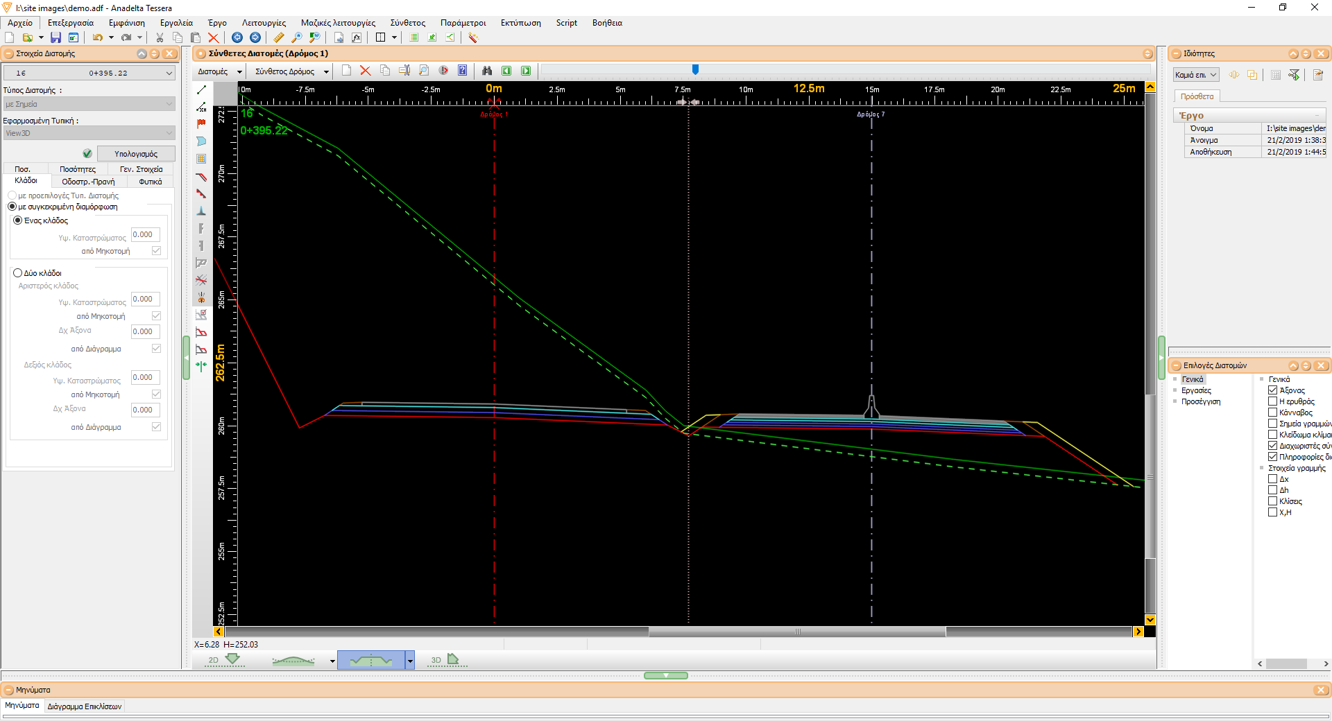
Σύνθετες διατομές
Η δημιουργία των σύνθετων διατομών γίνεται εύκολα και μαζικά για το σύνολο των διατομών του κύριου δρόμου με πλήρη έλεγχο του τρόπου σύνθεσης. Μετά την επεξεργασία των διατομών σε κάθε δρόμο ξεχωριστά, γίνεται η αυτόματη δημιουργία των διατομών του σύνθετου δρόμου καθορίζοντας τόσο τη χρονική σειρά υπολογισμού των δρόμων όσο και το αν θα υπάρχει ένα ενιαίο ή πολλά χωματουργικά. Από αυτό το στάδιο και μετά ο σύνθετος δρόμος αντιμετωπίζεται ως ένας απλός δρόμος με όλες τις δυνατότητες επεξεργασίας, διόρθωσης και εκτύπωσης τόσο των σχεδίων όσο και του πίνακα χωματισμών. Τέλος παρέχεται η δυνατότητα ενημέρωσης προς τα "πίσω" των διατομών των επιμέρους δρόμων τόσο για την ορθή ενημέρωση της οριζοντιογραφίας όσο και για την εξαγωγή των προμετρήσεων / επιμετρήσεων ανά δρόμο.
Πλατείες Ανεμογεννήτριας
Στην έκδοση Pro υποστηρίζεται η αυτοματοποιημένη δημιουργία ενός εδάφους- πλατείας ανεμογεννήτριας. Μπορούν εύκολα να παραμετροποιηθούν τα πρανή της και να υπολογιστούν οι εκσκαφές και επιχώσεις της πλατείας ανεμογεννήτριας.